How to Spec Drill Rig Access on a Wooded Geotech Site
When a site engineering firm lays out a boring plan on a wooded parcel, the locations are picked for the soils data — not for what the drill rig can actually drive to. That gap is where projects lose days. A wooded slope, a creek crossing, or a wall of privet between the road and the first boring location can stall a $5,000/day rig before it pulls a single core.
This is the part we get called for. Below is how we approach drill rig access and bench construction on wooded sites in Alabama, with photos from a recent apartment-complex geotechnical job near Birmingham.
What "access" actually means for a track-mounted drill rig
Most geotech rigs working in central Alabama are track-mounted, 6 to 9 feet wide, and need:
- A trail wide enough for the tracks plus a couple feet of margin — call it 10 feet minimum, 12 feet comfortable
- Overhead clearance for the mast in the down/traveling position
- A grade the rig can climb without spinning — usually under about 20% sustained
- A turnaround or pull-through at each boring location, not a dead-end the rig has to back out of
- A level pad (bench) at the actual sample point big enough to deploy outriggers and pull rod
If any of those are missing on site day, the rig sits.
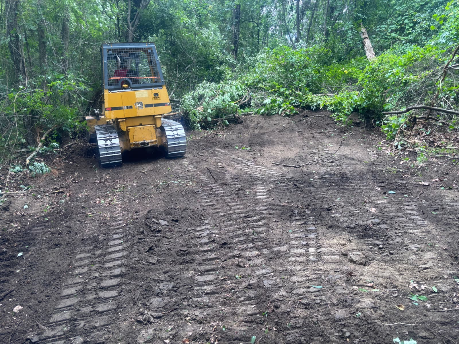
Cutting trails through the side of a hill
The photo above is from a recent job: an apartment-complex parcel where the boring plan called for sample points spread across heavy timber on a sloped hillside. The drill rig couldn't reach a single location cold.
We cut access through the side of the hill — keeping cut and fill balanced so we weren't trucking dirt around — and benched in level pads at each boring location. A few notes from how we approach this kind of work:
- Mulch what you can, only dig what you have to. Forestry mulching the trail line first gets you a clean cut without ripping up the soil profile the geotech is about to sample. If the slope needs reshaping, the dozer follows behind.
- Bench the rig pad slightly oversized. A bench that's exactly the rig's footprint becomes a problem the first time the operator wants to swap rods or set a casing.
- Daylight the trail uphill, not downhill. Cutting into the hill (rather than filling out from it) means the trail holds up better under repeated rig traffic and a thunderstorm.
- Leave drainage. A bench that ponds water after one rain is a bench the rig won't sit on.
What to send your clearing sub before the rig shows up
If you're a site engineer or geotech firm bidding a wooded parcel, the fastest path to a real access quote is:
- The boring location plan (PDF or DWG is fine — pin drops also work)
- A parcel boundary so we know what's in play
- The rig spec sheet or at least width / overhead height / max grade
- A target date the rig needs to roll
From that we can walk the property, lay out the trail and bench locations, and give you a fixed number before you mobilize the rig. On the apartment job above, the rig pulled cores on schedule and rolled out without a single access delay — that's the bar for every commercial sub job we run.
Working in Central Alabama
We handle drill rig access trails, benching, and pre-construction clearing for site engineering and geotechnical firms across Jefferson, Shelby, Blount, and St. Clair counties. If you have a job bidding, send the boring plan and we'll put a number together.
Related services
Keep reading
What Engineering Firms Should Look For in a Site Clearing Sub
Hiring a land clearing sub for an engineering project isn't the same as hiring one for a homeowner. Here's the checklist we'd use if we were on your side of the table.
What Is Forestry Mulching? A Plain-English Guide for Property Owners
Forestry mulching grinds trees, brush, and undergrowth into a clean mulch layer in a single pass — no burn piles, no hauling, no torn-up soil. Here's how it works.